


Opportunity
Cameron Parish along the Gulf Coast is the third largest parish in Louisiana, but because much of it is wetland, its population is less than 7,000. The parish comprises most of the state’s Chenier Plain, which is marked by coastal ridges known as cheniers.
Cameron Parish was devastated by Hurricane Audrey in June 1957, by Hurricane Rita in 2005, and by Hurricane Ike in 2008. The shoreline between Holly Beach and the jetties at the outlet of the Calcasieu Ship Channel had eroded rapidly, from 5 to 30 feet per year. The channel, constructed in the 1920s, connects the Gulf of Mexico with the Port of Lake Charles more than 30 miles inland.
Speaking in 2013, Governor Bobby Jindal said, “If we don’t restore this land, that tidal surge not only comes through Cameron Parish, it gets to the wetlands and ultimately to the people of Lake Charles as well.” Mayor Randy Roach of Lake Charles said, “If those ridges go, the next thing you know, the Gulf of Mexico is at the Intracoastal Canal.”
Kimberly Davis Reyher of the Coalition to Restore Coastal Louisiana said, “As we know in this area, our coast is really our future and we are experiencing a crisis of land loss. We are losing wetlands, we are losing beaches, and we are losing marshes. It is critical for us to find ways to restore these areas — critical for wildlife and for our community.”
Solution
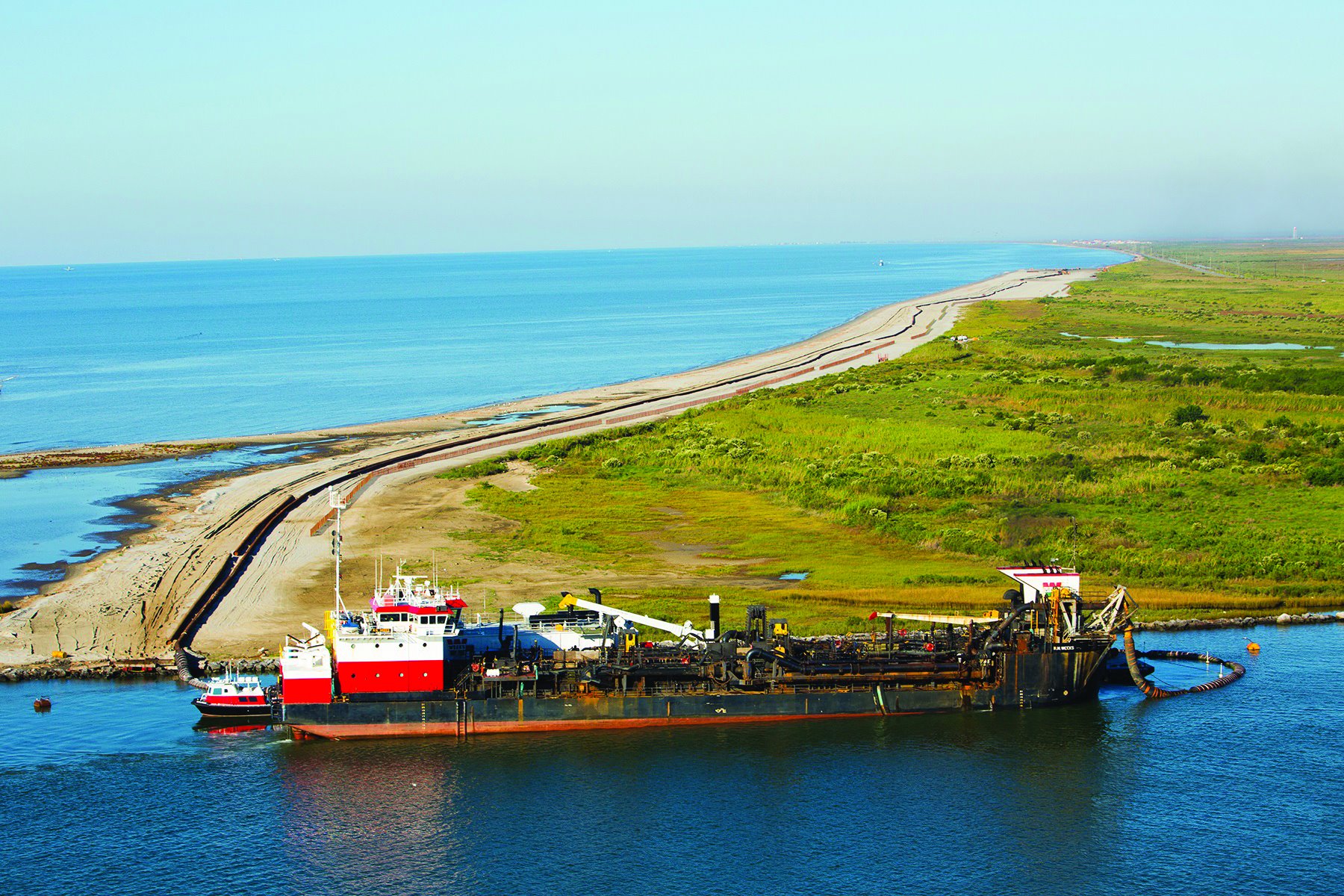
In 2009, Mott MacDonald was retained by the Coastal Protection and Restoration Authority (CPRA) to provide analysis, design, permitting services, and construction oversight for a project to restore about 9 miles of coastline between Holly Beach and the Calcasieu Ship Channel.
We performed detailed engineering analyses and numerical modeling to develop an understanding of coastal processes, determine causes of shoreline retreat, and develop design criteria for beach nourishment. We analyzed five beach nourishment alternatives and recommended one for the final design.
Beginning in 2013, hopper dredges were used to collect sandy sediment from the Sabine Banks in the Gulf. After the dredges docked alongside the ship channel, the sediment was pumped to the beach through a pipeline 26,000 feet long. About 2 million cubic yards of sediment were deposited in all.
In June 2013 and September 2014, volunteers planted tens of thousands of plugs of dune grass to help stabilize the restored shoreline.
Outcome
According to the CPRA, the project “will keep the shoreline position at or seaward of the current position for 20 years and lessen the chance of losing the beachfront, the road, and the marshland ecosystem.”
“What you’re seeing here,” said Governor Jindal, “is really the state’s effort to protect our people, to protect our property from the next hurricane and from coastal erosion.”
“Billions of dollars of investments are bringing a new vitality to this treasured part of our state,” Jindal continued. “This progress is a result of our firm commitment to projects like this that protect our families and their homes, and to not only rebuild and protect our infrastructure, but to do it in the most sustainable way possible.”
In November 2014, a rare “meteo-tsunami” struck the coast of Cameron Parish. Like tsunamis caused by seismic activity but on a smaller scale, meteo-tsunamis are caused by storm and tide conditions. Although four feet of floodwater was reported on streets near Holly Beach, damage to the restored shoreline was minimal.
According to a news report, “Most of the sand fencing west of Holly Beach was destroyed, and debris littered the highway in both directions. The east side fencing was damaged, but mostly remained in place. A number of the posts were snapped off at the base, but enough still stood to give a scalloped appearance to the fencing. The new sand project amazingly remained in place.”