Back
Moata Geospatial provides a web-based mapping platform for entire project teams to easily view, understand and get insights from all of a project's location-based data.
Designed to meet the needs of infrastructure professionals, it provides an authoritative, single source of truth you can rely on for accurate and current information, aiding collaboration between infrastructure teams located anywhere in the world.
Create a digital twin of your project
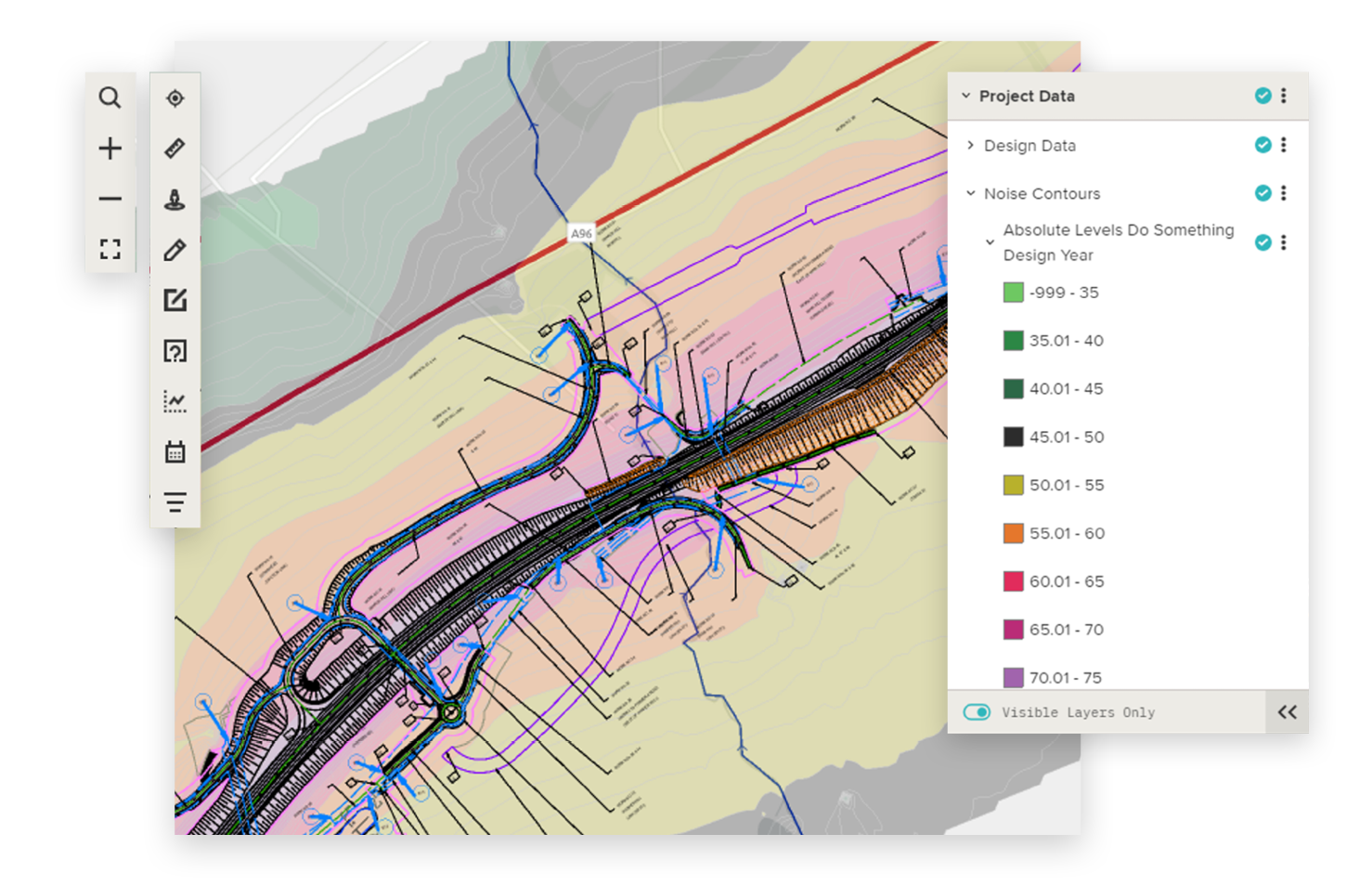
At its core, Moata Geospatial provides a system for displaying all of a project's location-based data, allowing the creation of a digital representation of the real world, which can support teams throughout the lifecycle of infrastructure assets. Your team can rely on Moata Geospatial for accurate and current information, removing data version control issues and increasing the efficiency at which project members can find and use information.
Moata Geospatial is a technology-agnostic mapping solution that provides rapid access to trusted information at every stage of project delivery, allowing cross-disciplinary teams to collaborate on geospatial data in real time. It can be used to complement and add value to existing systems, rather than replacing them.
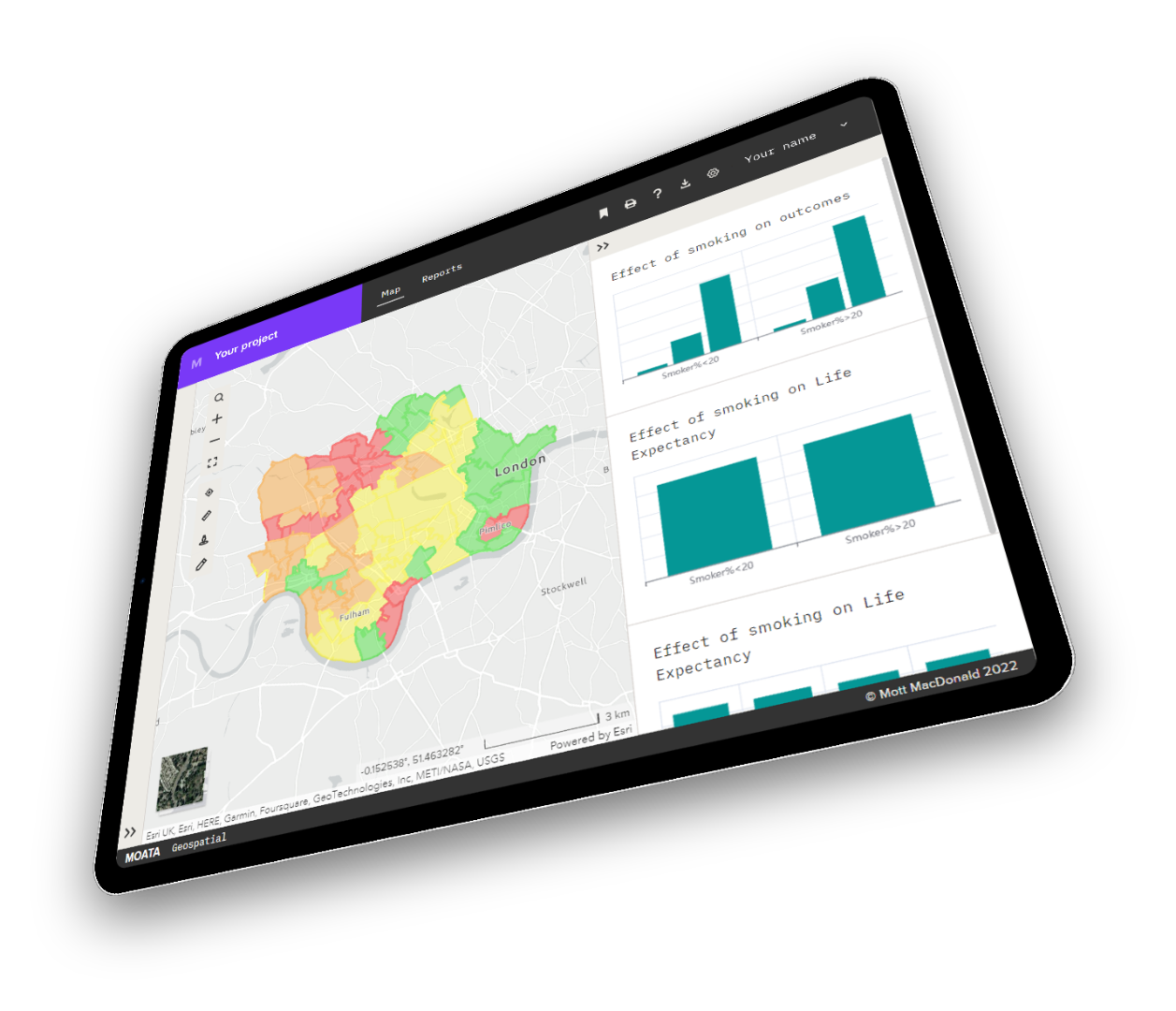
Get insights from data and make informed decisions
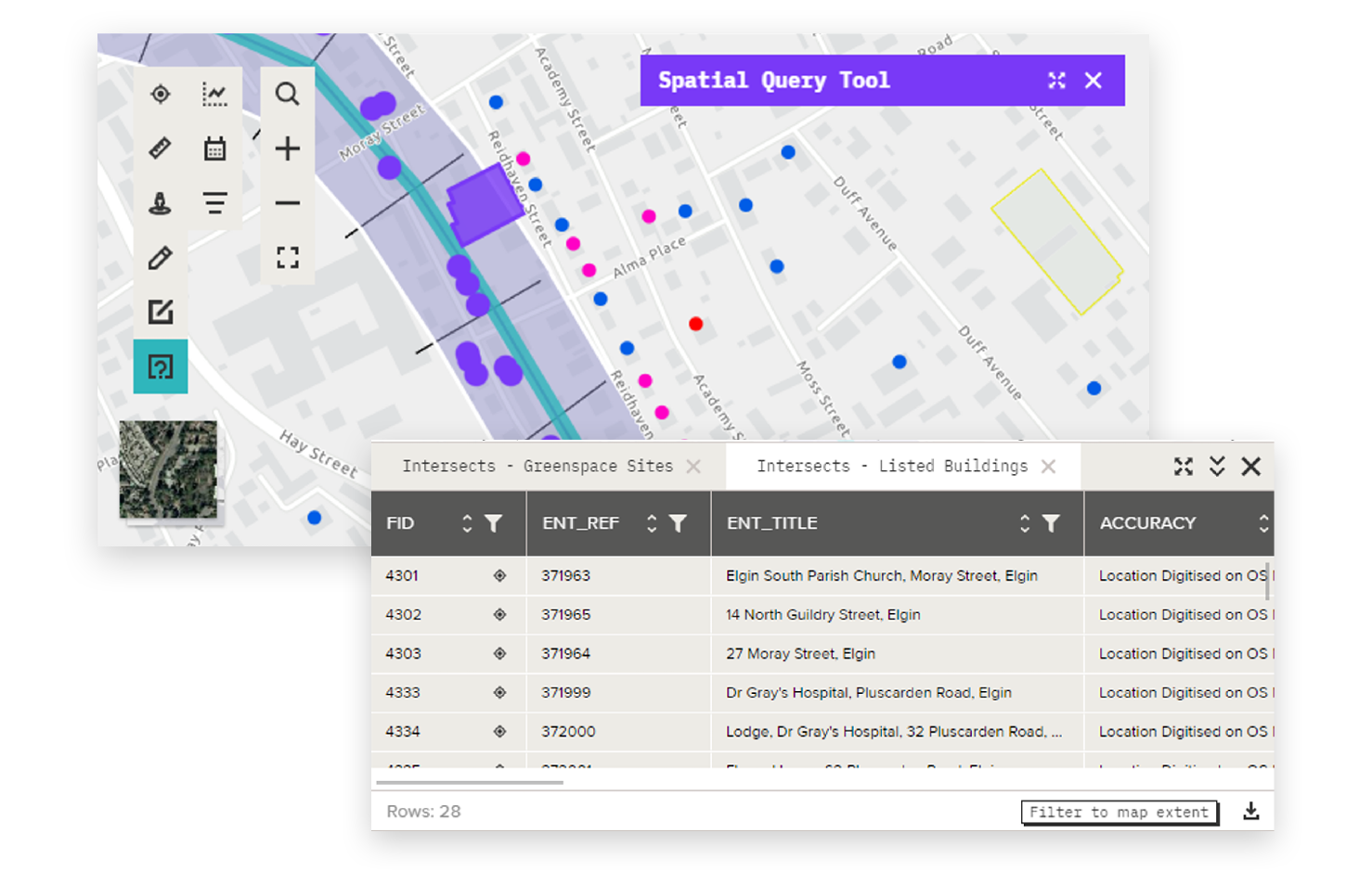
Make use of the diverse tooling and powerful analytical engine within Moata Geospatial to rapidly get insights from your data. Use our spatial query tool, integrated reporting, and data science capabilities to understand what you’re seeing and inform key decisions.
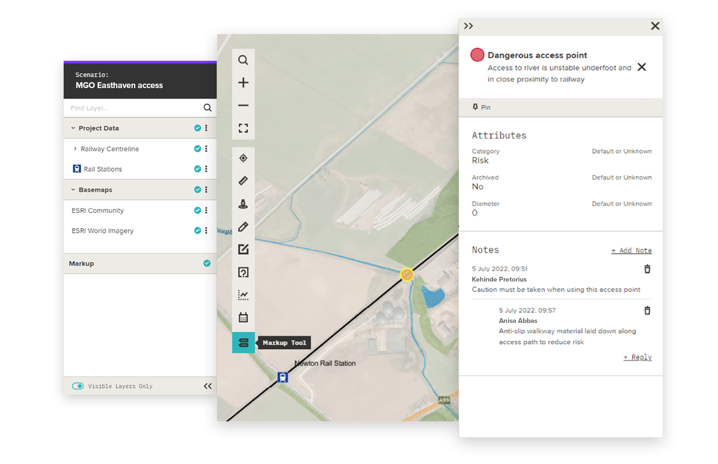
Enjoy widescale collaboration across teams
Collaboration is at the heart of Moata Geospatial with teams anywhere in the world able to access the system. The addition of our mark up and comments tool makes it easy to record considerations and issues directly on the map, with the associated comments thread facilitating and recording discussions between teams, all in one place.